Services
3D scanning
With laser 3D scanning, surveying becomes faster, more accurate, and more useful for those who need to use it.
In hazardous conditions, it increases the safety of the surveyor.
Request a consultationServices
With laser 3D scanning, surveying becomes faster, more accurate, and more useful for those who need to use it.
In hazardous conditions, it increases the safety of the surveyor.
Request a consultationVerkís offers three-dimensional laser scanning with the help of a laser scanner. With this new technology, the surveying of structures and/or the environment will be much faster and more accurate.
The use of laser scanners has increased significantly in the neighbouring countries, along with the use of models and BIM (Building Information Modeling) in design and construction.
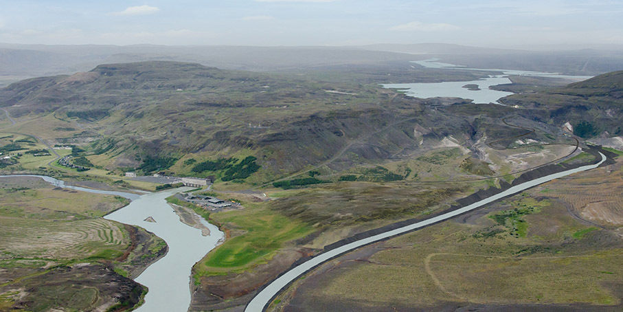
A laser scanner can photograph the surfaces facing it. The environment is scanned from different angles to get a complete overview. Structures can be scanned both externally and internally and assembled into one whole. The result is a point cloud.
The point cloud forms a three-dimensional model of the structure. In many cases the point cloud is sufficient as a reference, but in some cases a model of the point cloud must be drawn.
A scanned image of a structure is used as a basis for design and analysis of various kinds. Scanning reduces risk and potential inconsistencies in maintenance, renovations, and extensions. During the construction period, scanning can be used for monitoring, for example, to test design models for the actual construction.
Verkís uses a Focusˢ 150 Laser scanner together with software from Faro. This is a device that can scan its surroundings with high accuracy in a short amount of time.
Faro Focusˢ 150, properties:
– Measures one million dots per second
– Has a 150 metre range
– Error margin ±1 millimetre
Contacts

Andrés Gísli Vigdísarson
Civil Engineer B.Sc.
Division: Infrastructure
agv@verkis.is

Birgir Hauksson
Electrical and Business Industrial Engineer
Division: Buildings
bih@verkis.is
Verkís supports clients in creating accurate digital twins of buildings, infrastructure, and industrial assets through advanced 3D scanning and reality capture services. By providing precise as-built data, our specialists help improve project planning, design coordination, asset management, and decision-making, reducing risk and increasing efficiency across the entire project lifecycle.
We develop accurate models of existing conditions to support renovations, upgrades, and modifications. By capturing and documenting current assets, we help reduce uncertainty, improve coordination, and enable more efficient project planning and design.
Verkís supports clients in analysing site conditions for new buildings through accurate data collection, surveying, and digital modelling. Our specialists provide the information needed to optimise design, reduce risk, and support efficient project delivery from concept to construction.
We use BIM models to assess and compare construction approaches, helping clients optimise buildability, cost, scheduling, and project performance before construction begins.
Verkís supports clients in surveying and documenting existing conditions for prefabricated building units. Our specialists provide precise measurements and digital models that improve design accuracy, manufacturing efficiency, and installation quality.
Verkís supports clients with regular quantification of earthworks using surveying and digital measurement technologies. Our specialists provide accurate volume calculations and progress assessments that improve planning, cost management, and project oversight.
Verkís supports clients with monitoring services that verify compliance with project accuracy requirements. Using advanced surveying and measurement technologies, our specialists provide reliable data to support quality control, risk reduction, and successful project delivery.
We provide surveying, measurement, and digital modelling services that support the planning, operation, and maintenance of assets within the shipping industry.
We provide accurate documentation and registration of archaeological relics, supporting heritage preservation, planning processes, and informed decision-making.
We support quality control in production through accurate measurements, verification, and digital documentation, ensuring compliance with design specifications and quality requirements.
Verkís supports clients with field research services, including data collection, site investigations, and surveying. Our specialists provide accurate and dependable information that forms the foundation for effective planning, design, and project execution.
We provide 3D scanning services that transform real-world environments into accurate digital data. Our specialists deliver reliable reality capture solutions that support planning, design, construction, and asset management while reducing uncertainty and improving project efficiency.
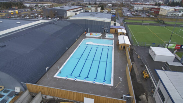
Hotel Saga has undergone extensive renovations in recent years. Throughout this redevelopment project, Verkís has been responsible for project management as well as all engineering design services.